Picture yourself stepping off your back porch and onto your boat in Wrightsville Beach. Before you fall in love with a sound-front view or a marsh-side lot, make sure your dream dock is actually possible. Riparian rights and dock permits in North Carolina can be confusing, and small site details often determine what you can build.
In this guide, you’ll learn what riparian rights really mean, how the permitting process works around Wrightsville Beach, and the practical steps to confirm feasibility before you buy. You will walk away with a clear checklist and smarter questions to ask, so you can move forward with confidence. Let’s dive in.
Riparian rights basics in NC
What riparian rights mean
Riparian rights are a set of rights tied to waterfront ownership that relate to reasonable use of adjoining water. They often include access to the water, the ability to moor a vessel, and the potential to build a dock or pier if it complies with law and public trust rules. These rights are a starting point, not a guarantee of any specific structure.
What transfers when you buy
Riparian rights typically run with the land. In most cases, they transfer when the property sells unless they were reserved, sold, or extinguished. You should confirm the status through the deed, title search, and any recorded easements. If a property relies on a community dock or an access easement instead of direct frontage, your rights and options can be very different.
Limits and the public trust
North Carolina manages tidal and submerged lands under the public trust doctrine. If your dock would occupy or cross state-owned bottomlands or navigable waters, you will need state authorization. Private riparian rights do not override public trust protections, and they do not automatically allow construction without permits.
Who permits docks here
State and federal roles
Around Wrightsville Beach, the North Carolina Division of Coastal Management administers Coastal Area Management Act permitting for docks, piers, bulkheads, and shoreline work in coastal areas. The North Carolina Department of Environmental Quality handles related water quality certifications and tidal wetlands determinations. The U.S. Army Corps of Engineers, Wilmington District, reviews structures in navigable waters and activities that place fill or dredge material in waters and wetlands under federal law.
Local rules in Wrightsville Beach
The Town of Wrightsville Beach and New Hanover County apply zoning, building, stormwater, and floodplain standards. Barrier island municipalities often adopt rules that are more protective than state minimums to maintain navigation, safety, and community character. Always expect local reviews in addition to state and federal oversight.
How reviews interact
Many projects require parallel approvals. You may need a CAMA permit, federal authorization from the U.S. Army Corps of Engineers, a state water quality certification, and local building and floodplain permits. Early conversations with the Town of Wrightsville Beach and the Division of Coastal Management can clarify which permits apply, likely design constraints, and realistic timelines.
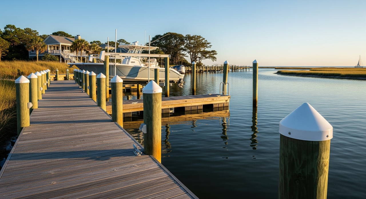
Site factors in Wrightsville Beach
Tidal marsh parcels
Salt marshes and small tidal creeks are highly regulated. Filling marsh or converting it to upland is usually prohibited or faces intense scrutiny. Where a pier crosses marsh, designs that avoid marsh fill, use pilings, and keep structures elevated are generally more acceptable than hardened approaches.
Sound-front parcels
Sound-front properties face open estuarine waters, including areas like Masonboro Sound. These shorelines see wind, waves, and storm surge. Dock designs must account for navigation, water depths, and erosion risk. Placement near channels can trigger additional coordination to ensure there is no obstruction to navigation.
Environmental constraints
Sensitive resources can shape design and schedule. Common considerations include avoiding tidal wetland impacts, protecting submerged aquatic vegetation, and observing timing windows for species like shorebirds or sea turtles. North Carolina encourages living shorelines as an alternative to hard stabilization in many settings.
Practical local constraints
Narrow barrier island lots and required setbacks can limit how and where you place a pier. Shifting inlets and shoals can affect access depth and may complicate any dredging proposal. Local ordinances often set standards for length, location, and spacing to maintain navigation and community aesthetics.
Your due diligence checklist
Use this checklist before you assume a private dock is feasible:
- Title and deed review
- Confirm riparian rights, any recorded easements, or HOA rules that affect docks.
- Verify whether existing structures have recorded permits or leases.
- Site analysis
- Order a current survey that shows mean high and mean low water lines, corners, and structures.
- Check water depths, tidal range, marsh presence, and channel proximity.
- Early agency consults
- Schedule pre-application conversations with the Town of Wrightsville Beach, New Hanover County, and the North Carolina Division of Coastal Management.
- Permit pathway
- Confirm whether you need a CAMA minor or major permit, federal authorization, and any state authorization to occupy submerged lands.
- Technical studies
- Plan for site plans, piling and structural designs, wetland delineations, and biological surveys if needed.
- Professional team
- Engage a coastal engineer, surveyor, marine contractor, and an attorney familiar with riparian rights.
- Contract protections
- If you are under contract, include contingencies for dock feasibility and permitting, and allow time for reviews.
- Long-term ownership costs
- Budget for maintenance, insurance, potential lease fees for state bottomlands, and storm repairs.
Timelines and costs
What drives timing
Simple replacements or small piers with minimal impacts can move faster once applications are complete. Projects that involve federal review, wetland mitigation, or submerged land authorizations usually take longer. Expect permitting to add months, and in complex cases, the process can extend past a year.
Common cost drivers
Your total cost depends on site complexity and design. Key drivers include surveying and engineering, application and processing fees, materials and piling installation, any required mitigation or living shoreline components, and ongoing maintenance and insurance. Where state submerged land leases apply, those fees add to the ownership picture.
Smart design choices
Elevated piers vs bulkheads
Where marsh is present, elevated structures on pilings help avoid fill and reduce impacts. Bulkheads and other hard shoreline stabilization often face stricter review and stronger justification requirements. If erosion protection is needed, consider options that minimize resource impacts.
Living shorelines
North Carolina promotes living shorelines in many coastal settings because they provide erosion control while supporting habitat. Designs may blend natural elements with engineered features. In some cases, a living shoreline can be both environmentally preferred and more practical to permit.
Dredging considerations
If a concept requires dredging for access, plan for additional permits and a more rigorous review. Dredging can trigger federal and state approvals, water quality certification, and possible mitigation. Given inlet dynamics and shifting shoals near Wrightsville Beach, feasibility varies by site and should be evaluated early.
Protect your contract
Contingencies to include
If you are buying a waterfront or marsh-adjacent property with dock plans in mind, protect your interests with clear contingencies. Include time for surveys, pre-application meetings, and permit determinations. Add language that allows you to withdraw or renegotiate if permits, authorizations, or site conditions make your intended dock infeasible.
Next steps with a local guide
Here is a simple path to move forward:
- Order an ALTA survey that shows tidal lines and existing improvements.
- Request a title search for riparian easements, leases, and restrictive covenants.
- Set up pre-application calls with the Town of Wrightsville Beach and the North Carolina Division of Coastal Management to sanity-check your concept.
- Ask a coastal engineer or experienced marine contractor for a preliminary layout and alternatives, such as an elevated pier or a living shoreline.
If you want a property that truly fits your boating plans, early coordination is everything. A local, concierge approach can save you months and help you avoid costly dead ends. If you are exploring Wrightsville Beach or nearby coastal markets, reach out to Joseph Zuba for a practical feasibility game plan and introductions to the right specialists.
FAQs
Do riparian rights guarantee a private dock in Wrightsville Beach?
- No. Riparian ownership is helpful, but all structures must pass local, state, and federal reviews, and site constraints may prevent construction.
How do I know if a property actually has riparian frontage?
- Order a current survey that shows mean high and mean low water lines and compare with the deed and any recorded easements or community dock covenants.
Which agencies review private dock permits near Wrightsville Beach?
- Expect the North Carolina Division of Coastal Management, the North Carolina Department of Environmental Quality, the U.S. Army Corps of Engineers, and local town and county departments to be involved.
What is the difference between a CAMA minor and major permit?
- Both are Coastal Area Management Act permits. The category depends on project scope, location, and potential impacts, which you should confirm with the Division of Coastal Management.
Are bulkheads easier to permit than elevated piers?
- Often no. Hardened shoreline stabilization can face stricter review than elevated piers, and North Carolina frequently encourages living shoreline alternatives.
Can I dredge to get boat access on a shallow lot?
- Sometimes, but dredging requires additional state and federal permits and a higher level of environmental review, and it may not be feasible in all locations.
What happens if my neighbor’s dock is close to my property line?
- Neighbors cannot obstruct navigable waters, but riparian allocations, easements, and local standards can limit placement. Disputes may require legal guidance.
How long should I plan for permitting before construction?
- Simple, low-impact projects can move faster once applications are complete, but complex cases with federal review or wetlands issues can take many months or more than a year.